
by Citizen Review staff
Washington, D.C. – Nov. 22, 2019 – The infamous Wild Olympics legislation is back – and moving forward in the U.S. House of Representatives. U.S. Representative Derek Kilmer (D) introduced H.R. 2642 – a bill to “designate and expand wilderness areas in Olympic National Forest in the State of Washington, and to designate certain rivers in Olympic National Forest and Olympic National Park as wild and scenic rivers, and for other purposes.”
This Act is called the “Wild Olympics Wilderness and Wild and Scenic Rivers Act ”. The bill has been referred to the Committee on Natural Resources.
Wild Olympics has been around for a long time. George Rains, Sr. wrote about this in 1992, as a “land grab”. Here’s what he said, in part:
“A complete land corridor taken over by the National Park Service bordering the Pacific Ocean from the south boundary of the Makah Indian Reservation south to the north boundary of the Quinault Indian Reservation. The purpose to completely take over this valuable ocean frontage to block out resort development, industry and private home frontage on the Pacific Ocean.
“Also to completely circle Lake Ozette with a land corridor on the Olympic Peninsula, thus preventing any resort development, industry or home sites by the public. In furtherance of their conspiracy of the National Park Service was the taking of a very wide corridor on each side of Quinault River from the park boundary in a southwesterly direction to the Quinault Indian Reservation.
“In furtherance of the National Park Service conspiracy is the taking of a very large area bordering Lake Quinault on the north side of that lake.
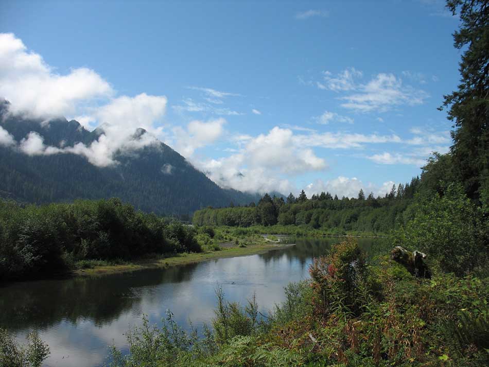
According to the Act, if passed, the following Federal land in the Olympic National Forest in the State of Washington comprising approximately 126,554 acres, as generally depicted on the map entitled “Proposed Wild Olympics Wilderness and Wild Scenic Rivers Act” and dated April 8, 2019 (referred to in this section as the “map”), is designated as wilderness and as components of the National Wilderness Preservation System:
(10) MOONLIGHT DOME WILDERNESS.—Certain Federal land managed by the Forest Service, comprising approximately 9,117 acres, as generally depicted on the map, which shall be known as the “Moonlight Dome Wilderness”.
(11) SOUTH QUINAULT RIDGE WILDERNESS.—Certain Federal land managed by the Forest Service, comprising approximately 10,887 acres, as generally depicted on the map, which shall be known as the “South Quinault Ridge Wilderness”.
(12) COLONEL BOB WILDERNESS ADDITIONS.—Certain Federal land managed by the Forest Service, comprising approximately 353 acres, as generally depicted on the map, is incorporated in, and shall be managed as part of, the “Colonel Bob Wilderness”, as designated by section 3 of the Washington State Wilderness Act of 1984 (16 U.S.C. 1132 note; Public Law 98–339).
(13) SAM’S RIVER WILDERNESS.—Certain Federal land managed by the Forest Service, comprising approximately 13,418 acres, as generally depicted on the map, which shall be known as the “Sam’s River Wilderness”.
(14) CANOE CREEK WILDERNESS.—Certain Federal land managed by the Forest Service, comprising approximately 1,378 acres, as generally depicted on the map, which shall be known as the “Canoe Creek Wilderness”.
(238) MIDDLE FORK SATSOP RIVER, WASHINGTON.—The approximately 7.9-mile segment of the Middle Fork Satsop River from the headwaters to the Olympic National Forest boundary, to be administered by the Secretary of Agriculture, as a scenic river.
“(239) WEST FORK SATSOP RIVER, WASHINGTON.—The approximately 8.2-mile segment of the West Fork Satsop River from the headwaters to the Olympic National Forest boundary, to be administered by the Secretary of Agriculture, as a scenic river.
“(240) WYNOOCHEE RIVER, WASHINGTON.—The segment of the Wynoochee River from the headwaters to the head of Wynoochee Reservoir to be administered by the Secretary of Agriculture, except that portions of the river within the boundaries of Olympic National Park shall be administered by the Secretary of the Interior, in the following classes:
“(A) The approximately 2.5-mile segment from the headwaters to the boundary of the Wonder Mountain Wilderness, as a wild river.
“(B) The approximately 7.4-mile segment from the boundary of the Wonder Mountain Wilderness to the head of Wynoochee Reservoir, as a recreational river.
“(241) EAST FORK HUMPTULIPS RIVER, WASHINGTON.—The segment of the East Fork Humptulips River from the headwaters to the Olympic National Forest boundary to be administered by the Secretary of Agriculture, in the following classes:
“(A) The approximately 7.4-mile segment from the headwaters to the Moonlight Dome Wilderness boundary, as a wild river.
“(B) The approximately 10.3-mile segment from the Moonlight Dome Wilderness boundary to the Olympic National Forest boundary, as a scenic river.
“(242) WEST FORK HUMPTULIPS RIVER, WASHINGTON.—The approximately 21.4-mile segment of the West Fork Humptulips River from the headwaters to the Olympic National Forest Boundary, to be administered by the Secretary of Agriculture, as a scenic river.
“(243) QUINAULT RIVER, WASHINGTON.—The segment of the Quinault River from the headwaters to private land in T. 24 N., R. 8 W., sec. 33, to be administered by the Secretary of the Interior, in the following classes:
“(A) The approximately 16.5-mile segment from the headwaters to Graves Creek, as a wild river.
“(B) The approximately 6.7-mile segment from Graves Creek to Cannings Creek, as a scenic river.
“(C) The approximately 1.0-mile segment from Cannings Creek to private land in T. 24 N., R. 8 W., sec. 33, as a recreational river.
“(244) QUEETS RIVER, WASHINGTON.—The segment of the Queets River from the headwaters to the Olympic National Park boundary to be administered by the Secretary of the Interior, except that portions of the river outside the boundaries of Olympic National Park shall be administered by the Secretary of Agriculture, including the following segments of the mainstem and certain tributaries in the following classes:
“(A) The approximately 28.6-mile segment of the Queets River from the headwaters to the confluence with Sams River, as a wild river.
“(B) The approximately 16.0-mile segment of the Queets River from the confluence with Sams River to the Olympic National Park boundary, as a scenic river.
“(C) The approximately 15.7-mile segment of the Sams River from the headwaters to the confluence with the Queets River, as a scenic river.
“(D) The approximately 17.7-mile segment of Matheny Creek from the headwaters to the confluence with the Queets River, as a scenic river.
“(245) HOH RIVER, WASHINGTON.—The segment of the Hoh River and the major tributary South Fork Hoh from the headwaters to Olympic National Park boundary, to be administered by the Secretary of the Interior, in the following classes:
“(A) The approximately 20.7-mile segment of the Hoh River from the headwaters to Jackson Creek, as a wild river.
“(B) The approximately 6.0-mile segment of the Hoh River from Jackson Creek to the Olympic National Park boundary, as a scenic river.
“(C) The approximately 13.8-mile segment of the South Fork Hoh River from the headwaters to the Olympic National Park boundary, as a wild river.
“(D) The approximately 4.6-mile segment of the South Fork Hoh River from the Olympic National Park boundary to the Washington State Department of Natural Resources boundary in T. 27 N., R. 10 W., sec. 29, as a recreational river.
“(246) BOGACHIEL RIVER, WASHINGTON.—The approximately 25.6-mile segment of the Bogachiel River from the source to the Olympic National Park boundary, to be administered by the Secretary of the Interior.
“Nothing in this Act alters, modifies, diminishes, or extinguishes the reserved treaty rights of any Indian tribe with hunting, fishing, gathering, and cultural or religious rights in the Olympic National Forest as protected by a treaty.”
Representative Kilmer can be contacted at: http://kilmer.house.gov/contact/offices
Recent Comments